The thirteen hour drives to and from Scotland were mostly evidence that I have developed the capacity to sleep my way through long journeys, with occasional periods for socializing and working out where we are. As such, it wasn’t really until we were camping outside Shiel Bridge and doing our first hike that I got to know the other members of our group. The most notable thing about the drive is perhaps the pub where we stopped for dinner. I had vegetarian haggis (quite good) as well as a pint of kelp ale. Most other people had the normal haggis, though some opted for the surprisingly generous portions of fish and chips that seem to be standard in Scotland.
As I said before, a majority of the trip members were physical scientists. One leader was a biochemist, one was studying quantum chromodynamics (a field that has to do with quarks and the strong nuclear force), and one is presently working in medical imaging, but is leaving in five weeks to go to opera school – quite a significant change of tack. Among the nine of us, there was only one undergraduate, which was probably on account of the trip happening during the summer. The two people on the trip with whom I spoke most were Kathleen – a South African student of political theory, doing work on transitional justice – and Mark – an engineer working with autonomous robots. I am also grateful to Bruno, one of the leaders, for his excellent advice on how to partially fix my extremely sore legs after our grueling first day.
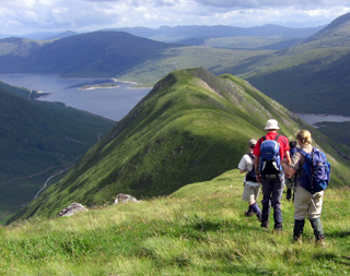
The Five Sisters of Kintail
That first day began with the ascent of a ridge in the rain. Unfortunately, my Gore-Tex jacket is not performing as it did in the days of its youth (at least eight years ago) and it was pretty comprehensively soaked through by the time we reached the misty top. That said, with all the exertion, the water was not particularly unwelcome.
The five sisters consist of five peaks, three of which are Munros. Scotland includes 538 summits over 3000 feet, of which 283 were regarded as “separate mountains.” Those are the Munros, with certain requirements of disconnectedness from other nearby mountains. That ensures that climbing a Munro is always a fairly involved task – though Sir Hugh Munro climbed all the ones identified when he was alive, bar a single peak that isn’t climbable without fairly advanced rock climbing skills.
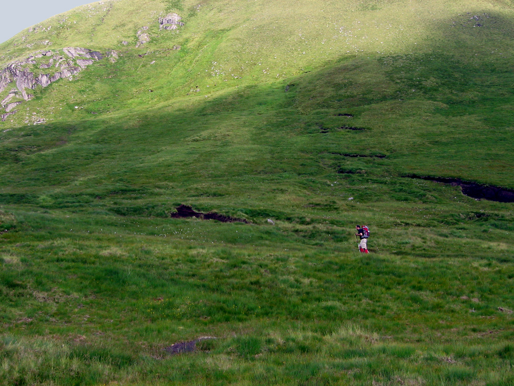
Every mountain we climbed (barring the small 350m hill on our day of recuperation from Friday) had a cairn of stones piled on top. The hillsides are all strewn with a kind of rock that is unfamiliar to me, and which tends to erode in geometrically distinctive ways, such as into blades and slabs. That, combined with the lack of any trees at high altitudes, contributes to the way in which the Highland mountains are both familiar and unfamiliar to someone used to the Rockies and the Coast Mountains.
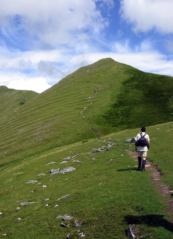
Walking along the ridgeline – ascending and descending – we climbed all five peaks in sequence. Astonishingly, Roman (a mathematician on the trip) and Andrew (the chemist leader) ran the final portion so as to be able to recover the minibus from the starting point. The rest of us were happy to take a bit more time to rest and take photos.
After descending from the fifth peak, we found ourselves first in properly pathless terrain. Because of the aforementioned lack of trees, there really aren’t many paths in the Highlands. There are just passable areas and less passable areas. First a steep and vegetation covered hill, then a bog proved closer to the latter.
That evening, and at all times thereafter up to the present, my legs were definitely complaining about going from months of puttering about in the flatness of Oxford to suddenly climbing a series of thousand metre mountains. I think my combination of appreciation for having done such and impressive hike and the general sense that something a bit more pedestrian should follow was universal throughout the group.
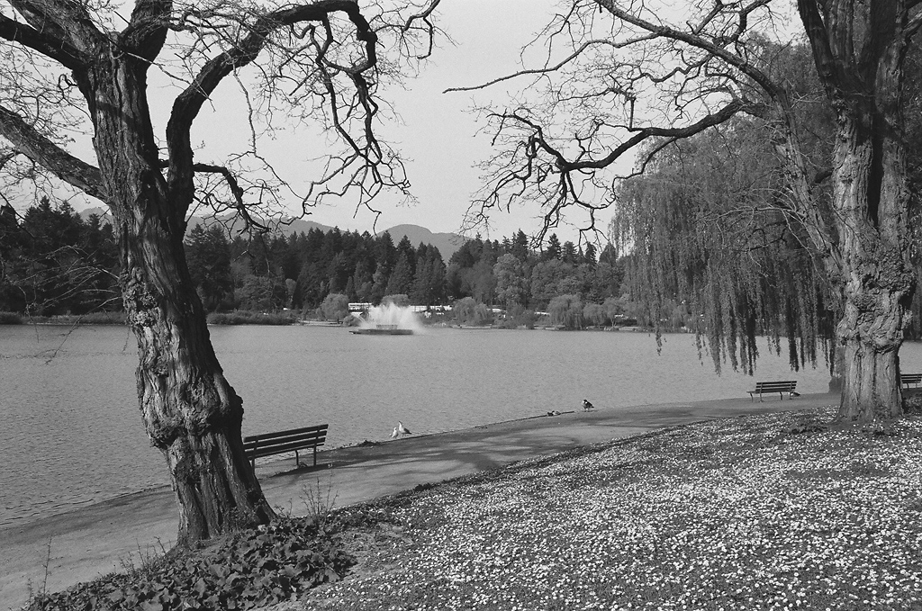
Walking along the Loch
After a nearly sleepless night (on account of sore muscles and evil omnipresent midges), I was glad that our second day was more sedate. We walked for about fifteen kilometres along the coastline of the loch, before climbing a relatively small hill. The vegetation was quite interesting. Some was very familiar: foxglove, many of the ferns, and the general mossiness of the forest. The trees, however, were not kinds I had commonly seen.
After eating lunch on a pebble beach and climbing the hill, we found our way back to the minibus. Several group members convinced the ferry drivers operating between the mainland and the Isle of Skye to let all nine of us and our vehicle across for a discount. The ferry was a very odd contraption, with a deck that pivoted around a central point so that cars could be loaded from the side. It was only big enough to hold two vehicles the size of our minibus, and the driver seemed inclined to bring it into the landing at speed.
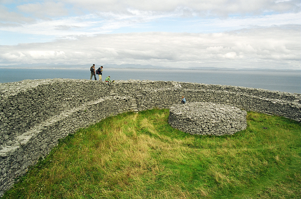
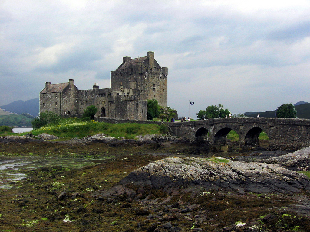
We did not spend a great deal of time on the Isle of Skye, mostly just having a look at the terrain before driving across to the bridge that connects it to the mainland. There, while following the loch back to camp, we stopped at an ancient looking castle connected to the mainland by a stone bridge. It was actually a twentieth century reconstruction and closed because a wedding was happening there. Four members of the group had varying levels of success as wedding crashers: three being turned back on the bridge and one making it as far as the island, to return in his own time.
Our meals were always quite similar: porridge in the morning; sandwiches, a packet of crips, two chocolate bars, and a piece of fruit for the hikes; and some kind of pasta and vegetable dish for dinners, with meat added for the 8/9 of the group who don’t share my dietary choice. Of all those things, I would hazard a guess that the chocolate bars were enjoyed most. They really are just the thing for when you are sitting, tired, on the shoulder of a mountain about 200m from the peak.
One last Munro
On Sunday, we had our last day of hiking. Firstly, we went up our fourth Munro under the best weather conditions so far. There was a blue sky, and you could see the shadows of the clouds moving along the mountainsides as they were carried along by the wind.
After that ascent, we had a choice between a hike that would involve two more Munros and rival Friday for length and difficulty, or the ascent of a single peak and the following of that ridgeline back to the minibus. Wisely, I think, we chose the latter and reached a pub for dinner just as it began to really rain.
That night, along with Mark, Kathleen, and Helen, I went for a walk in the drizzle along the loch. There, we found a pub and ensured that we would not leave Scotland without having had at least a dram of scotch. That may have partially explained why the last night was the only one where I slept quite soundly.
General impressions
Between the scenery, the exercise, and the company this was a really good trip. I really enjoy having diverse conversations with people in different fields, especially the sciences. Likewise, there is enormous satisfaction in a mountaintop view. It is both an affirmation of human agency – the ability to overcome so much gravity – and a humbling reminder of how briefly we live in the face of geology and millions of tons of rock.


