My friend Natalia made a suggestion that gave me a 24 hour respite from the misery of finding a room in Toronto, and we went back to the Hemlock forest near Catchacoma for an overnight camp.
One great thing about short visits to a place that has a brief and easy walk between where we parked and where we camped is that it allows for pretty quick and low-risk evaluation of gear for backpacking and camping. It’s feasible to bring two of something and try both, and not that bad if you only bring one version of something and it doesn’t work.
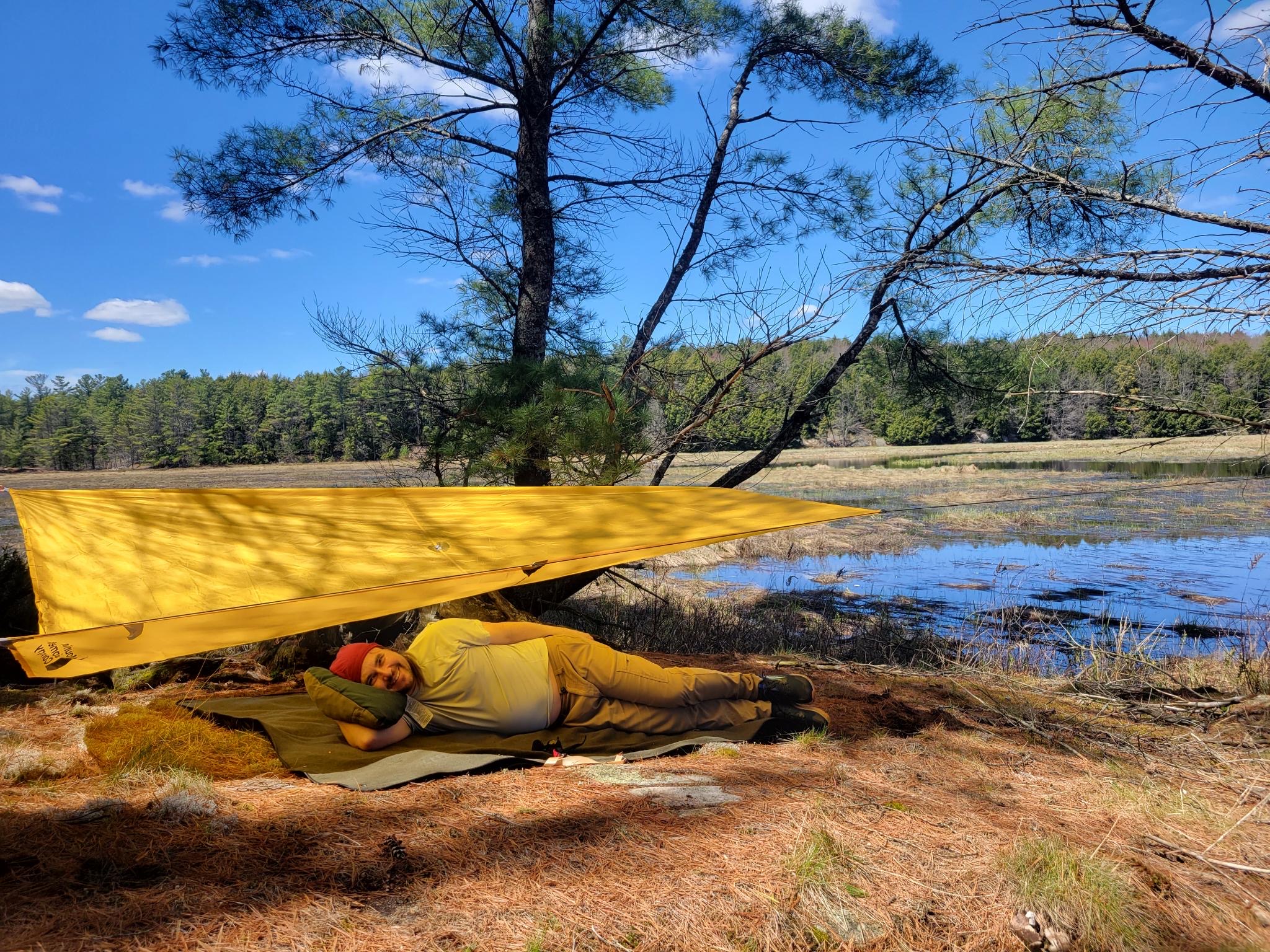
I have been so happy with my Savage Industries EDC ONE bag that even though I can’t say I ever had “buy a bedroll” on my to-do list, when I saw that they had made one I was curious about it. I have been very pleased with their stuff in the past and I know it sells out fast, so when they issued a second release I ordered one in time to have it to show off at this week’s bluegrass / hike planning evening.
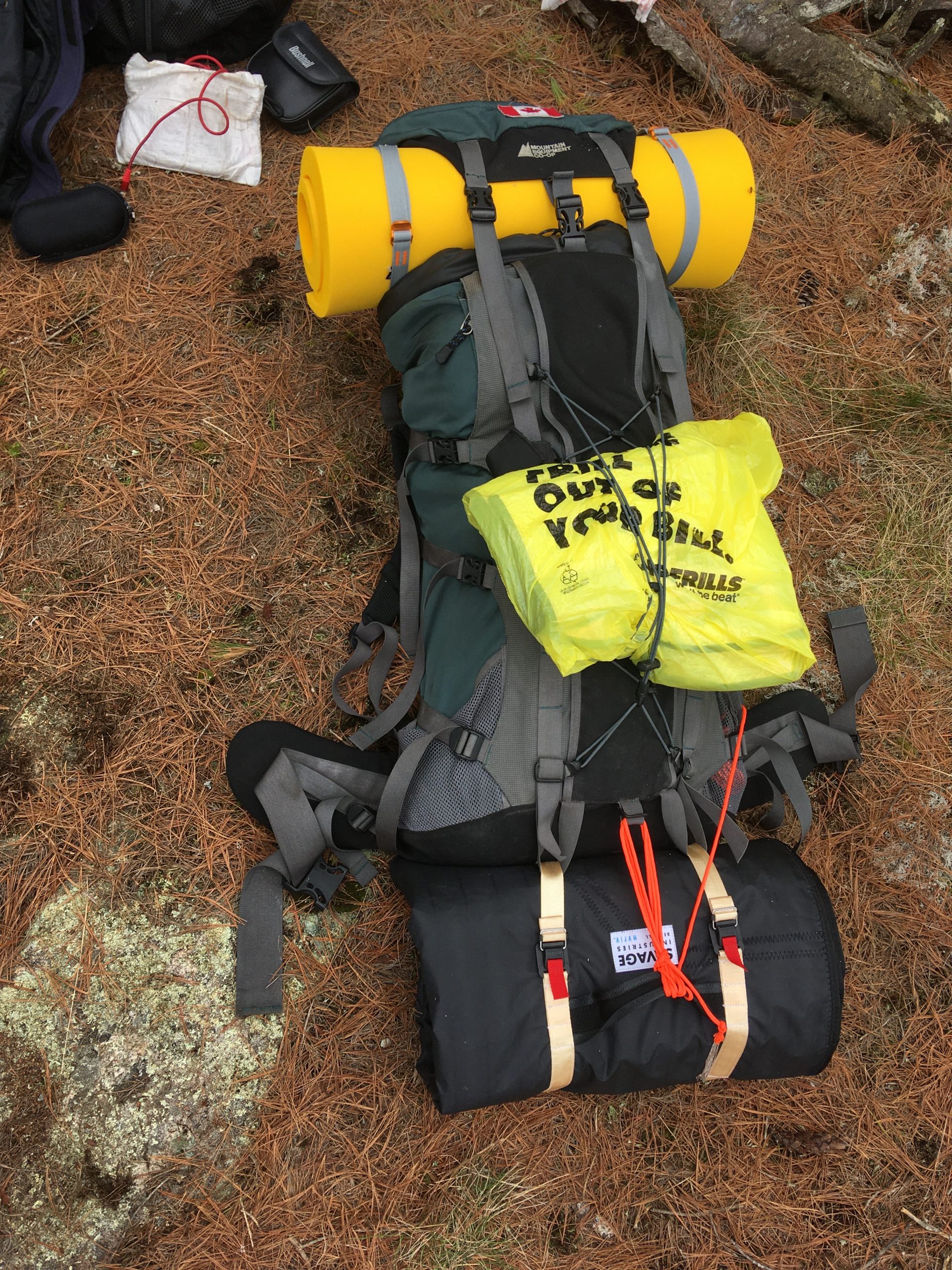
Before leaving, it seemed like a bit of a questionable camping item when a lot of people live some version of the ultralight philosophy. Just the bedroll weighs 4 pounds, and it rolls up into a package bigger than my tent or sleeping bag.
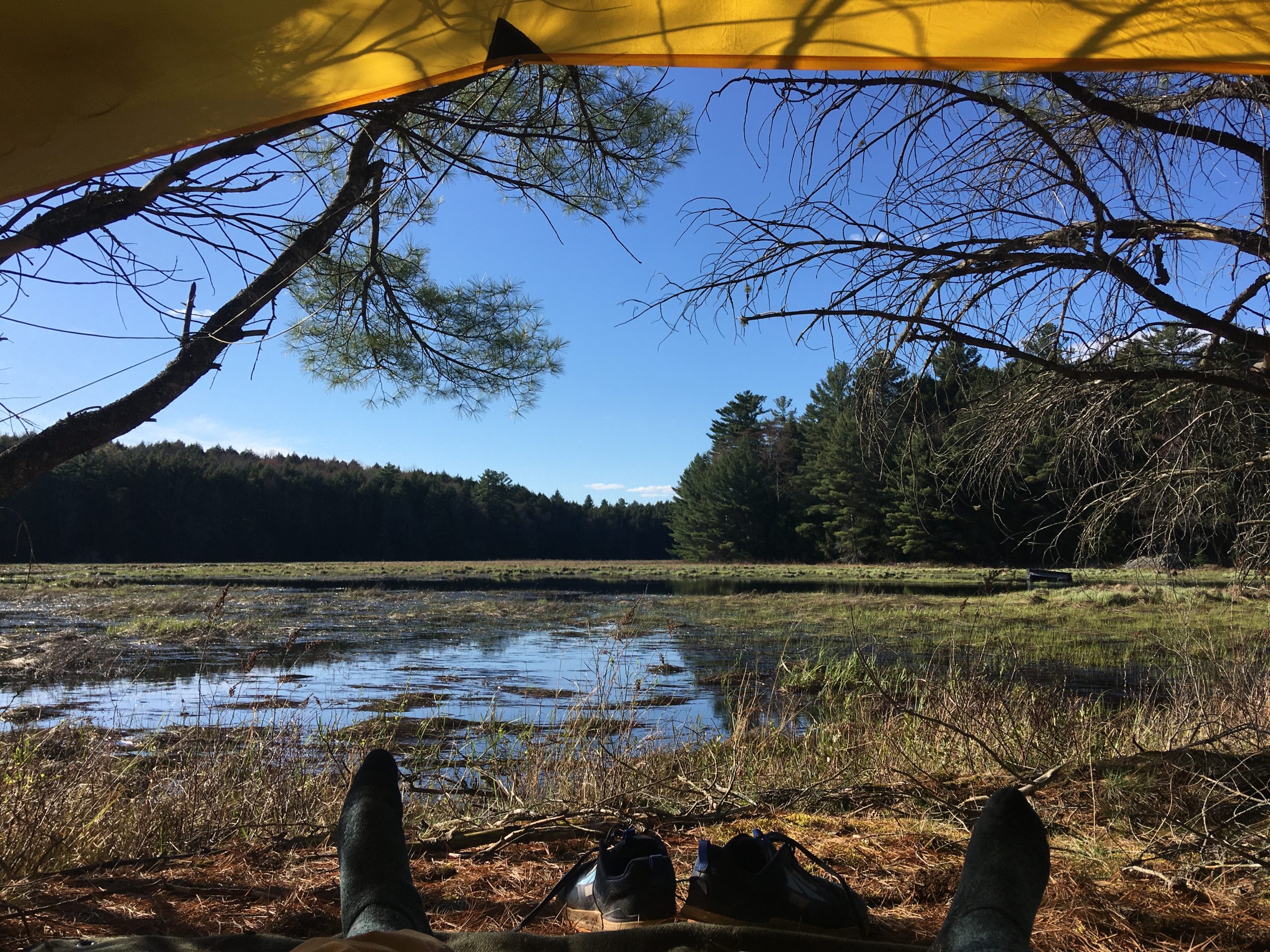
The design justified itself in the field for sure. It has waterproof sailcloth on the outside and a good warranty, so I felt fine about putting it down on little sticks and stones that I would move away from the area under my thin-floored tent. The wool platform was great to rest on after the hike in, and to watch the clouds from. At night, it was a great venue for stargazing, and I expect it will be good for tent-free “cowboy camping” later in the season.
Back in my tent — where on the last trip I spent all night curled at the bottom of my sleeping bag and shivering for warmth — I followed Natalia’s advice to put the bedroll above and below my light sleeping bag. In that configuration, I was warm with my sleeping bag unzipped until after dawn, and then warm with the bag zipped and light clothes on after. Note, however, that we had -11 ˚C and -9 ˚C nights last time, compared with +5 this time. (Though last time, I also used a fleece sleeping bag liner which I never had to pack this time, and slept in all my clothes rather than light PJs.)
One more nice unanticipated feature emerged when we were breaking camp: the bedroll is large enough to use as a soft, dry, and debris-free place to roll up my tent. Being able to pack up a tent clean saves times and annoyance, reduces the odds of needing to unpack it later in the day to dry or clean it, and probably extends the life of the tent.
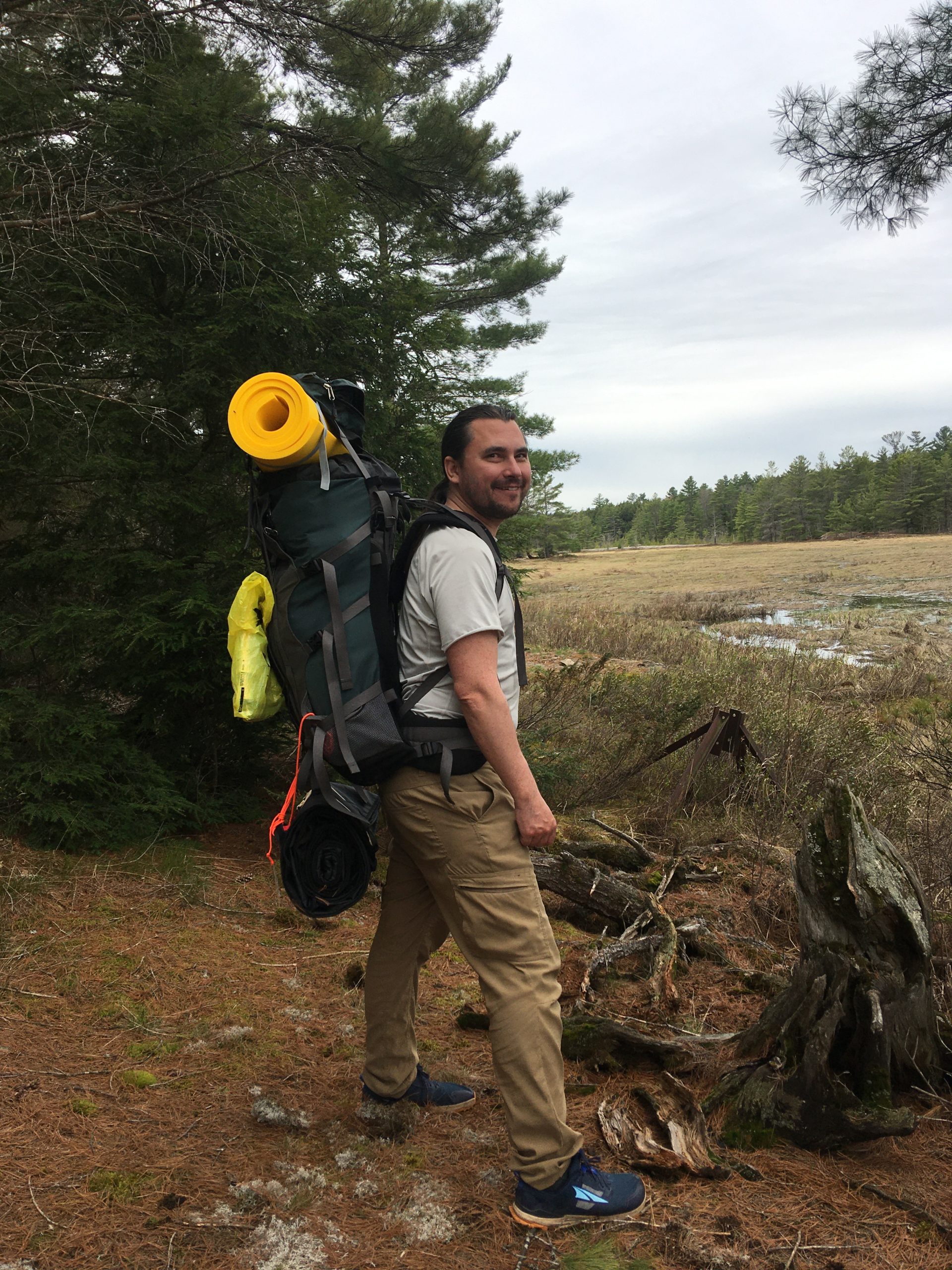
For the hike out, I even discovered that the integrated straps on the bedroll can be passed through two loops that were already there at the bottom of my pack. The bedroll still needs to be tied so that the middle doesn’t slide out of the roll, but the bedroll is nevertheless quite feasible to carry attached to the outside and bottom of a pack.
I probably would not carry it on a thru hike of thousands of kilometres, but it seems great for trips like this one plus picnics and Hive games in the park.