
While 2007 retains the record for the lowest observed mimumum summer Arctic sea ice extent, the level right now is the lowest ever observed for this time of year:

The US National Snow and Ice Data Centre explains the situation with reference to strong winds: “the growth rate slowed for a time in early October, coinciding with strong winds from the south over central Siberia. The winds helped prevent ice from forming along the Siberian coast. At the end of the month, extensive areas of open water regions were still present in the northernmost North Atlantic, and north of Alaska. The ice edge was north of both Svalbard and Franz Josef Land.”
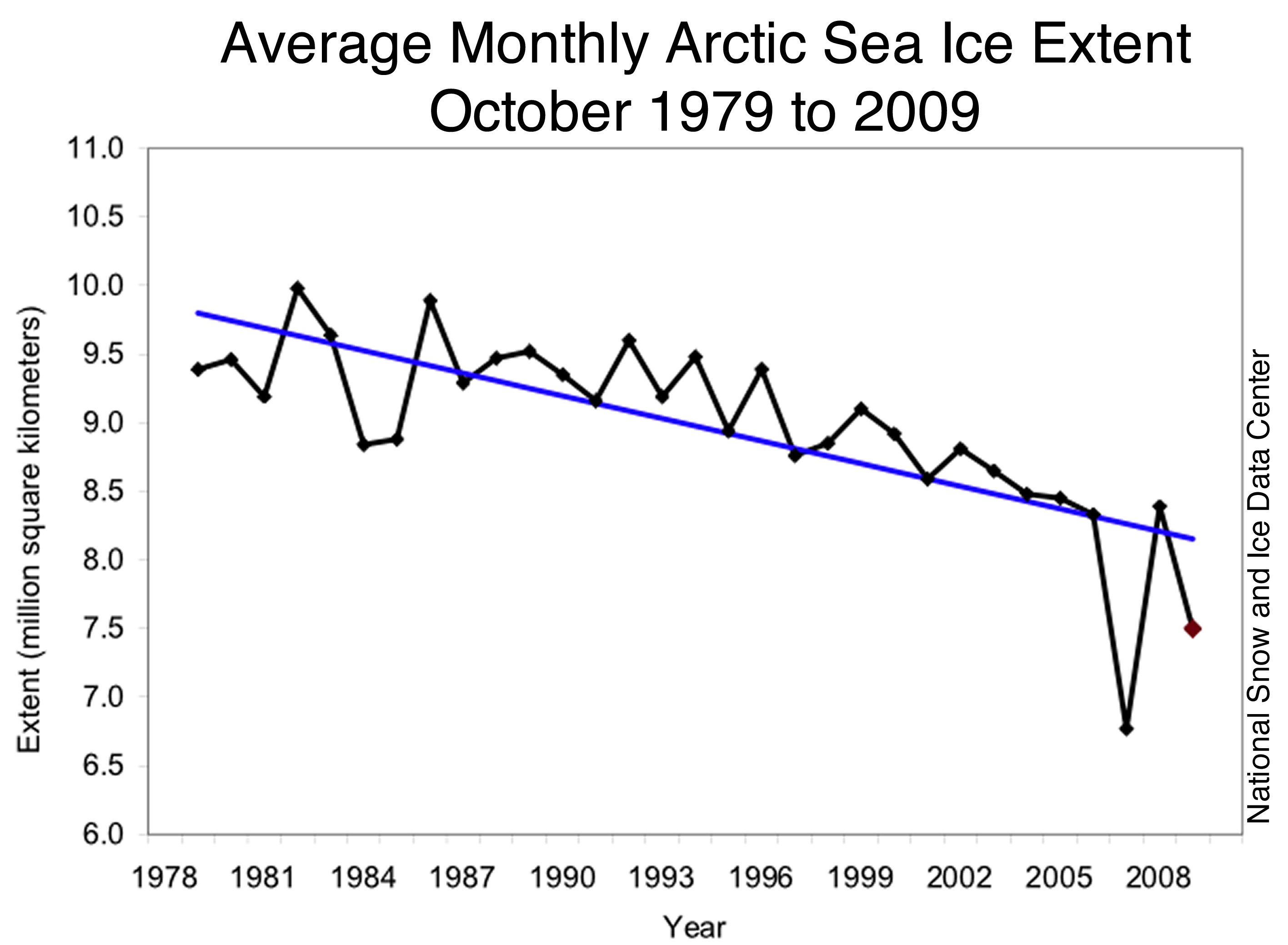
The year-on-year trend, going back more than 30 years, shows that fall ice has been progressively less extensive. Note that, at Canada’s northernmost permanent settlement nautical polar night conditions exist from late November to mid-January. During this time, “no trace of light can be seen anywhere but the sky is not completely dark at midday.” Further north, where the middle of the Arctic icecap is, this period of darkness extends even longer.
February 3, 2010
Despite cool temperatures, ice extent remains low
Despite cool temperatures over most of the Arctic Ocean in January, Arctic sea ice extent continued to track below normal. By the end of January, ice extent dropped below the extent observed in January 2007. Ice extent was unusually low in the Atlantic sector of the Arctic, the one major area of the Arctic where temperatures remained warmer than normal.