Surreal image
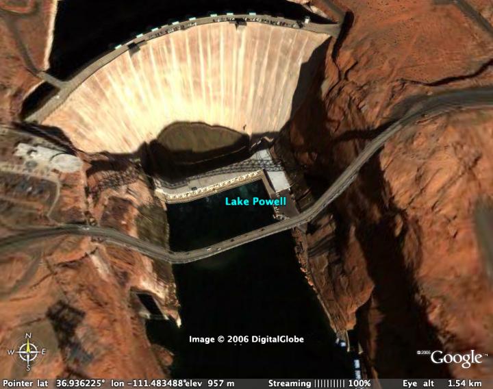
Normally, the Google Earth trick of taking altitude data from radar surveys and mapping aerial and satellite photographs on top has the neat effect of making the terrain look three dimensional. Sometimes, however, the radar map misses something and, when it draws the flat image onto the contoured terrain layer, you get a result like the one below:

3 Comments
Tristan took this photo from beside that dam.
Google Earth is an accidental Dali.
The shading and colouration make that look like a screenshot from Half Life 2.
Post a Comment
« Home